Caimari
Not even the most prestigious specialists in toponymy can not yet fully confirm any of the various hypotheses about what was the original meaning of Caimari, with a spelling that has also been modified over time (Caymarix li Aben-leube, Caymarix Labelembe or Caymaritx Labenleube, Queymaritx, Caymari).
But, without a doubt, the hypothesis to which preference is given is the one that attributes to Caimàritx the meaning of “set of caves”. To arrive, it is based on the phonetic fact that the sm group can become im, and exposes that Caimari could come from casmari, derived from chasma, abyss, in Greek.
To round out this climbing route to the etymology of Caimari, noting that near the town, there are a lot of natural caves. Historical events that took place within its territory have given name to popular celebrations or certain places like the Puig de n’Escuder or the Coll de sa Batalla.
The ethnological park, the old church or some stately homes we find are witnesses to the history of these lands. Finally, Caimari is the last population center before entering the popular pilgrimage of the Lluc monastery.
Source: ORDINAS GARAU, Antoni (1998) Caimari, apunts històrics i geogràfics.
Village images
Weekly market, fairs and celebrations
- Weekly market
Description: sale of fruit and vegetables, legumes, flowers and plants, clothing and footwear, etc.
Day: Mondays from 08:00 to 13:00
Place: Plaça Major (Main Square)
- Fairs and celebrations
16th and 17th November (Fira de s’Oliva)
15th August (Festa de la Immaculada)
Places of interest
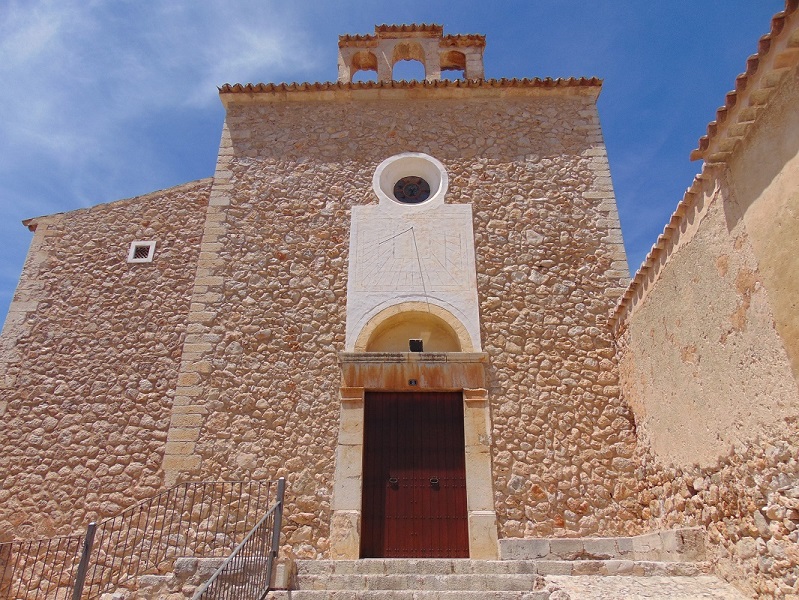
Placeta Vella, 3.
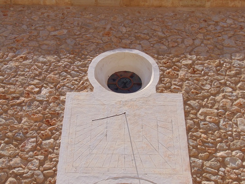
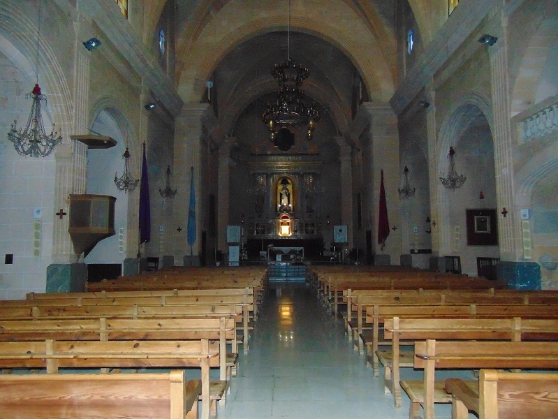
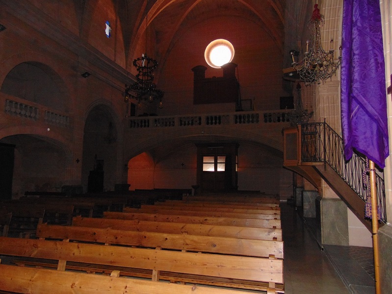
The building is made up of a single nave, with three sections.The presbytery is rectangular, slightly narrower than the nave, also covered by a pointed barrel and topped by a niche. In the 19th century, the side chapels (dedicated to Saint Joseph, Blessed Catherine, Saint Anthony and Saint Christ of Remei) were added, covered with a cannon turn. Also at the same time, the high choir was added, covered by an edge and located in the last section. On the left side is the access to the choir, while on the right side there is no presence of any chapel. From the outside it is necessary to emphasis the embellished portal of access of the XVIII century, above it we find a sundial installed in 1851.
Small oratory of the eighteenth century, located next to Son Albertí, which performed the church functions until the modern temple was built. The first stone was laid on April 15, 1732. In the mid-19th century, specifically between 1845-47, chapels were built to expand the space. The church stopped being used for the congegration approximately in 1890. Then it was used as a meeting place and as a movie theater until 1958. It was subsequently abandoned until in 1987 the Bishopric ceded it to the City Hall and the roof was rebuilded. Later, in 1998 the integral restoration of the building was carried out. Currently, the building has become a space destined to host cultural activities.
Placeta Vella, 1.
És una possessió que s’articula a partir d’una clastra interior a la qual s’accedeix per un majestuós portal rodó, rematat per un rellotge de sol. Des de la clastra podem accedir a les cases dels amos, dels senyors i també a les dependències agràries com l’antiga tafona i la pallissa. Cal destacar-ne també un espai cobert per quatre voltes d’aresta que neixen en un pilar central de pedra viva que, tot i trobar-se avui tapiat, configura un dels espais amb més qualitat del conjunt. L’edificació principal està construïda a diferent nivell. S’hi accedeix per una petita escala de pedra viva. El portal principal és de llinda amb els brancals motllurats. Al costat hi ha una finestra amb decoració d’estil renaixentista, amb columnetes anellades i capitells pseudojònics. A l’interior les cases han estat importantment modificades per una reforma de principis del segle XX. També s’ha de destacar la presència d’un aljub de notables dimensions, el jardí, els antics rentadors amb el pou i la volada de teules pintades.
Aquesta antiga possessió, situada devora l’església vella de Caimari, fou el nucli a l’entorn del qual es desenvolupà el poble. Es probable que les cases es corresponguin amb l’antic rafal de Caimaritx. En el Repartiment l’alqueria tocà a Guillem Boba, i al segle XIV els Boba entroncaren amb els Albertí, de qui la possessió prengué nom. En 1590, els Albertí posseïen més de la meitat del poble de Caimari.
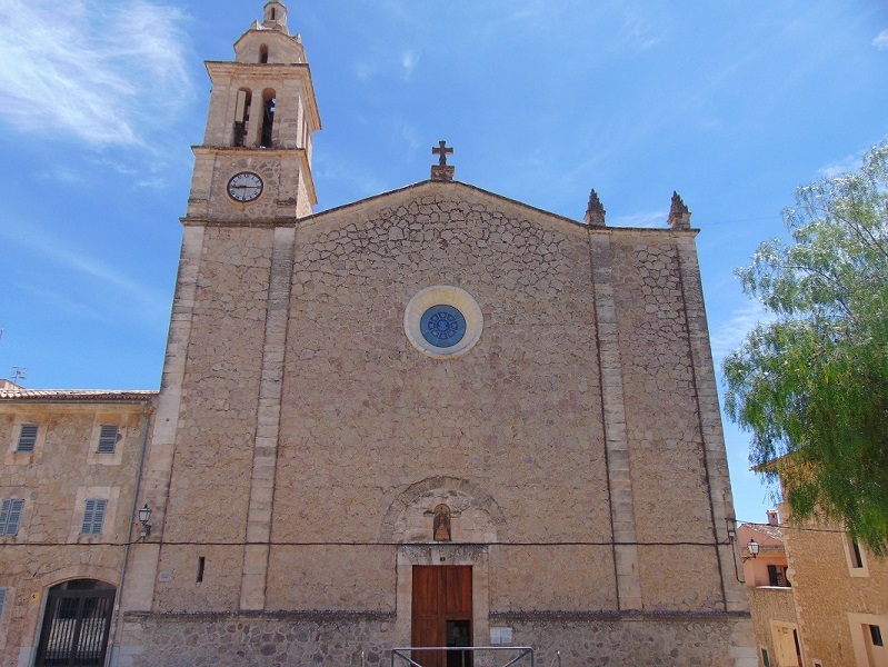
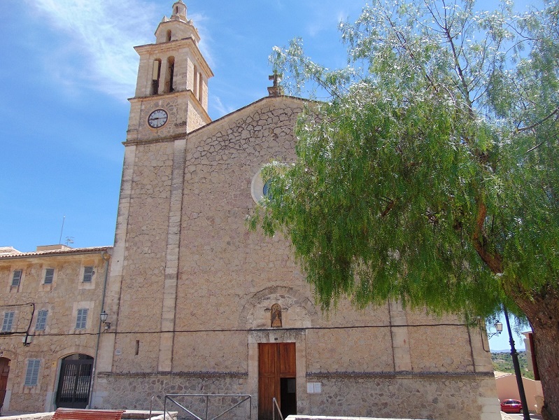
Plaça Major (Main Square), 1.
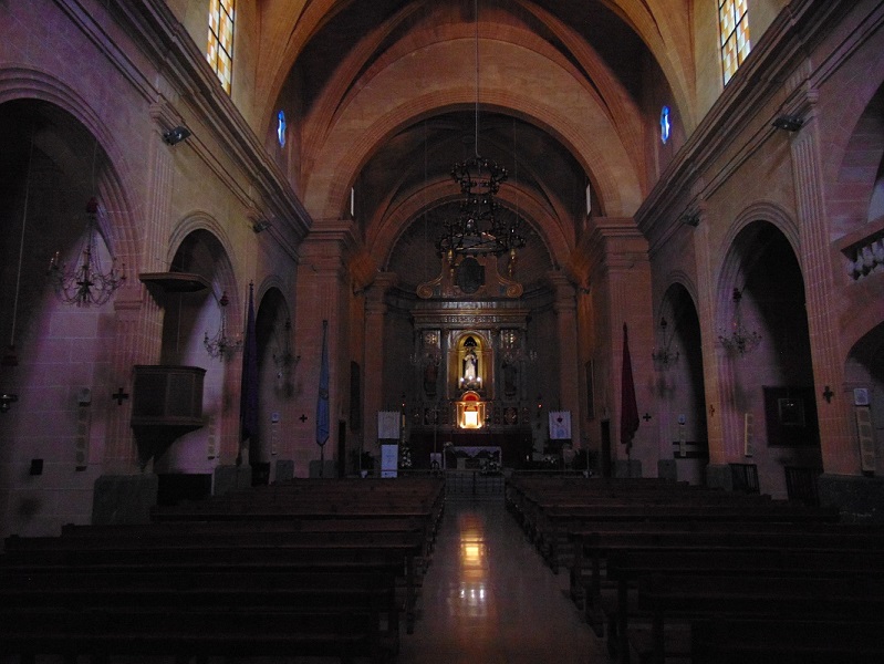
It is characterised by simplicity and austerity, as well as some neoclassical features. The main facade is formed by three bodies, one central - with the cover presided over by a Virgin Mary and the small rose window - and two lateral ones, the one on the right occupied by the bell tower. The interior is a rectangular plan of unique design, with lateral chapels and cannon turn. It seems that the materials used to build this church were extracted from the square where today we find the Plaça Major (Main Square) and that the hole that was formed was used to build the well.
The parish church of Caimari is a building built at the end of the 19th century (between 1877 and 1891).
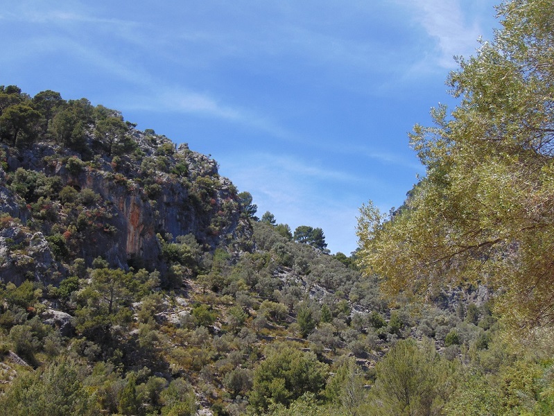
Leaving Caimari towards Lluc, leaving left. At 400 m, where the old Lluc road begins, there is a viewpoint with a few parking slots.
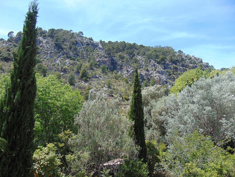
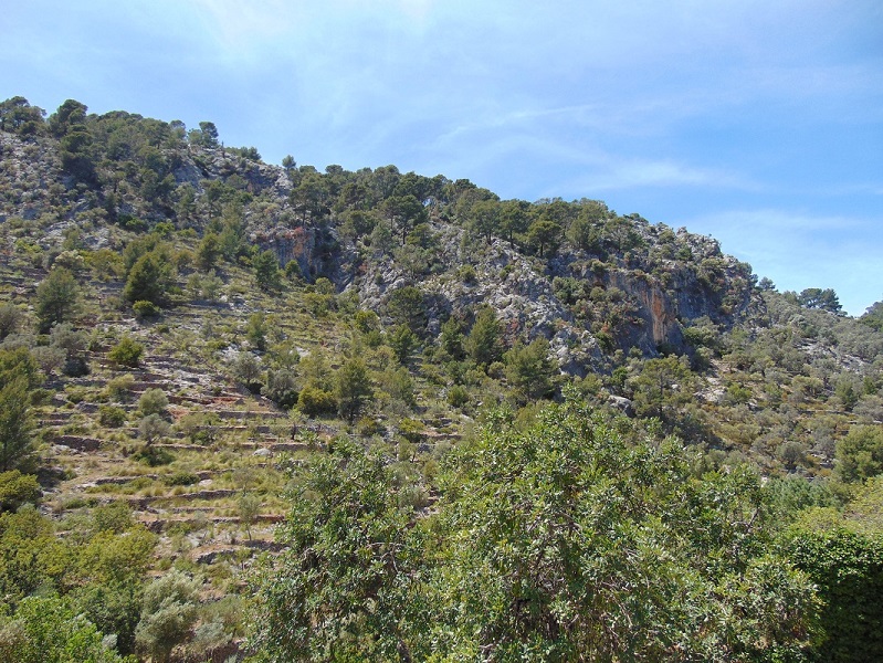
Possibly it is the best-known space of ‘‘marjades’’ in Mallorca. It consists of small properties that usually have an internal horseshoe path and a porch or shed. In the high part, the stone walls are very rudimentary, straight and braided. They are mostly planted with olive trees and to a lesser extent almond trees. In the lowest area, we find the torrent of the Black cave embedded between thick stone walls.
These are old communal lands that belonged to Caimari and that, between 1837 and 1853, were established for individuals who carried out the enormous task of building these terraces with stones, so-called ''marges'' in Catalan.

In the Ses Deveres area, south of the center of Caimari, next to the sports center.
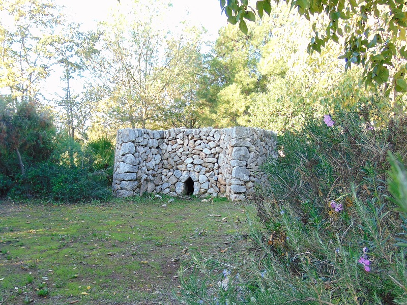
Currently, within the 3000 m² that the park occupies, reconstructions of elements linked to the exploitation of the nearby mountains can be found. So we can see a ’sitja coal’ with its coal hut, a bread oven, a snow house, a lime kiln, a bush fencing and a thrush trap among other elements. Each contains an explanatory poster that allows us to understand the uses and functions.
The Caimari ethnological park was inaugurated on November 16, 2002, within the framework of the fifth edition of the Sa Oliva Fair and since then it has been constantly expanding.
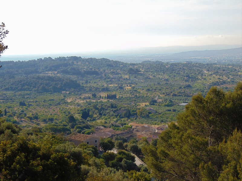
Located at the north of the town of Caimari, on both sides of the Lluc road, it borders the county terms of Escorca and Mancor de la Vall.
The commune of Caimari has an extension of 753 hectares characterized by its irregularity. Most of the surface is covered by olive trees with pine trees and, to a lesser extent, by the oak.
The rocks are colonized by the endemic plants, while several mountain species take refuge at the summits such as the rotaboc, the mata viera, pomera borda, etc. The flora is well diversified with about 250 species, among which 32 Balearic endemisms and 8 ground endemisms.
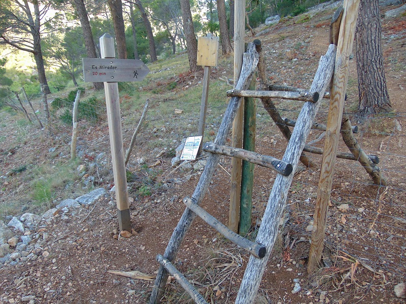
The Commune of Caimari has two recreational areas, one at the end of the street of the Fornassos de Caimari, and the other edge of the Lluc road, at the clot des Mercadal’ (km.10). It is important to note that the commune of Caimari is crossed by the old road of Lluc, an ancient pilgrimage route, which each year sees thousands of devotees and walkers.
Property of the SelvaTown Hall since its segregation of the district of Inca, in the fourteenth century. The commune of Caimari was subject to long lawsuits by individuals claiming their ownership. The year 1427 Guillem Albertí initiated the litigation that would continue for centuries with his descendants, Rafel Martorell and Guillem Mas Martorell, until in 1788, after several sentences and appeals, it was won by the City of Selva. The municipal ownership of the communes was ratified by a Royal Order of the Kingdom in 1830.
The sharp increase in population during the nineteenth century forced several establishments in the communal lands of Caimari (1837-1853) to allow the inhabitants of the term to have space to build or access the status as small landowners.
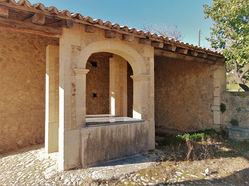

Road from Caimari to Mancor (road to Massanella), three hundred meters from the town of Caimari (left side).
It is one of the best examples of common wells in the whole region. Its structure presents the well, the speck, the neck, the pillars, and the porch. The well is shaped like a ferris wheel and its dimensions almost reach 4 m in length by 1'65 m in width, with a depth of 5 m. It is dry partitioned. The whole square of the well is paved. In its center, located on four large stone slabs, the neck is raised. It has a rectangular shape and is composed of four pieces of stone. The set is completed with four pillars of marès and stone that support the beams where the pulley is hung and help support the porch of the set.
It already existed in the fifteenth century, when it is documented as "puteum mayora". Until 1884 it consisted of a well covered with a little chapel. In this year it was enlarged and equipped with rollers, pikes, and arcades, with the help of the people and the marqués del Palmer, owner of the Massanella forest. In 1871 the pikes were moved to the Caimari Common well, since the water was considered of better quality. In 1889 the porch was renovated for a price of 20 pounds. At the end of 1998 it was restored by the Council of Mallorca.
Entre Caimari i el Santuari de Lluc (Escorca).
Es tracta d’una ruta de muntanya que inclou trams de camins d’èpoques molt diferents. El tram més antic és sa costa Llarga, fragment del primitiu camí de ferradura amb un empedrat de gran qualitat amb interessants ratlletes. A sa Llonganissa trobam un bon exemple de camí de carro amb escopidors, clavegueres, alguns paretons i trams empedrats. Ambdós trams gaudeixen de marges de suport, alguns tan espectaculars com el recentment restaurat bocí de sa bretxa Vella. Per altra banda, la carretera de Lluc (final segle XIX) gaudeix també de marges molt ben aconseguits (com el de sa bretxa Nova) i conté a més dos ponts destacables: el pont de Son Canta i el pont des Guix. De les set creus que flanquejaven el camí sols se’n poden veure dues al santuari de Lluc, a més del basament de la creu Nova. Són la creu de Ca s’Amitger i la creu des Barracar.
En el segle XIII ja hi referències de diversos camins per accedir a la capella de Lluc. Del camí original que pujava per Caimari, avui sols en roman en bon estat el tram denominat sa costa Llarga. A final del segle XIV es volgué santificar el penós camí amb la instal·lació de set esteles que representaven els goigs de Maria i el camí passà a anomenar-se camí de les Creus. La via necessitava contínues i costoses reparacions a causa del trànsit que suportava. Era especialment perillós l’anomenat pas des Grau. A principis del segle XVIII s’iniciaren les obres per construir el camí Nou de Lluc, camí de carro que facilitaria l’accés al santuari i la millora de les comunicacions per les possessions lluqueres. Els treballs d’aquest nou camí quedaren enllestits el 1714. D’aquesta obra ens queda bona part del traçat original. Finalment, l’any 1891 s’inaugurà l’actual carretera de Lluc que enllaça Caimari amb Lluc. Entre els anys 1989 i 1994 el Consell de Mallorca dugué a terme importants obres de restauració del camí vell Lluc. Molt més recentment s’ha senyalitzat com a sender de Petit Recorregut, integrat en la ruta Artà – Lluc, amb el número PR-222.
Weekly market, fairs and celebrations
- Weekly market
Description: sale of fruit and vegetables, legumes, flowers and plants, clothing and footwear, etc.
Day: cada dilluns, de 08:00 a 13:00
Place: Plaça Major (Main Square)
- Fairs and celebrations
16th and 17th November (Fira de s’Oliva)
15th August (Festa de la Immaculada)